ISA
/
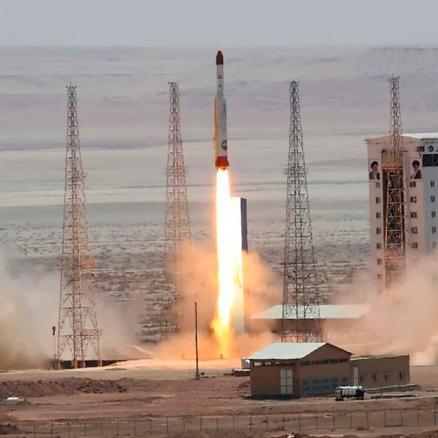
Zafar 1
Launch Failure
Liftoff Time (GMT)
15:48:14
Sunday February 9, 2020

Mission Details
Read Article
Launch Notes
Reports from Iran are that the rocket reached space but did not reach orbital speeds.
Zafar 1
Zafar are Iranian satellites with the mission to take high-resolution wall maps and aerial photos of locations around the globe. A ground resolution of 22,5 m (other sources 80 m) has been reported. The satellite is reportedly equipped with color cameras for surveying oil reserves, mines, jungles, and natural disasters. Two satellites of this type have been built. It is planned to orbit the Earth at an altitude of 530 kilometers.
Low Earth Orbit
1 Payload
113 kilograms
Launch Site
Stats
Simorgh
3rd
Mission
1st
Mission of 2020
Iranian Space Agency
12th
Mission
1st
Mission of 2020
2020
10th
Orbital launch attempt