DEMETER & Others
Launch Success
Liftoff Time (GMT)
06:30:06
Tuesday June 29, 2004

Mission Details
DEMETER
DEMETER (Detection of Electro-Magnetic Emissions Transmitted from Earthquake Regions) was a French micro-satellite operated by CNES devoted to the investigation of the ionospheric disturbances due to seismic and volcanic activity. It was launched on June 29, 2004 on a quasi Sun-synchronous circular orbit with an inclination of about 98.23° and an altitude of about 710 km. The altitude was changed to about 660 km in December, 2005. Due to the specific orbit, DEMETER was always located either shortly before the local noon (10:30 local time) or local midnight (22:30 local time). The satellite performs 14 orbits per day and measures continuously between -65° and +65° of invariant latitude. DEMETER observed an increase in ultra low frequency radio waves in the month before the 2010 Haiti earthquake. During the 2010 eruption of Mount Merapi, DEMETER noted anomalies in the ionosphere. Scientific operations ended December 9, 2010.
Low Earth Orbit
1 Payload
130 kilograms
Saudisat 2
SaudiSat 2 was built by the Space Research Institute of KACST (King Abdulaziz City for Science & Technology), a research center in Saudi Arabia. It is an experimental Earth observation satellite. It is capable of taking images with a resolution higher than 15m. It has the shape of a parallelepiped of dimensions 295mm x 295mm x 500mm and has a mass of 35kg.
Low Earth Orbit
1 Payload
35 kilograms
SaudiComsat 1 & 2
The satellites of the SaudiComsat series are the first generation of Saudi Arabian low orbit micro-communications satellites for commercial use, for the purpose of store and forward communications. The satellites built at the KACST Space Research Institute are based on the Saudisat 1 design. Reportedly they are part of a 24 satellite constellation planed to be launched in the future with different orbits to cover large parts of the world.
Low Earth Orbit
1 Payload
24 kilograms
LatinSat C & D
LatinSat, later renamed AprizeSat, is a constellation of small Low-Earth-Orbit satellites (64 satellites planned) to achieve a global communication system of data transmission and fixed and mobile asset tracking and monitoring. The satellites also carry experimental payloads.
Low Earth Orbit
2 Payloads
24 kilograms
AMSAT Echo
AMSAT-Echo was built by the American company SpaceQuest Ltd on behalf of AMSAT, the Amateur Radio Satellite Corporation. Having the shape of a 250mm cube, AMSAT-ECHO has a mass of 12kg. Each side of the cube is covered with a solar panel. AMSAT-ECHO is an amateur radio satellite. After the launch it was renamed AO-51 (AMSAT-OSCAR-51), according to the current nomenclature. It is indeed the 51st amateur radio satellite in history.
Low Earth Orbit
1 Payload
12 kilograms
UniSat 3
UniSat (University Satellite) are a series of small satellites developed at the Scuola di Ingegneria Aerospaziale by the Gruppo di Astrodinamica dell'Università degli Studi “La Sapienza University of Rome” to perform technology experiments and to check the use of non space rated equipment in space. The UNISAT program has been the first university program in Italy intended for promoting the use of commercial technologies in the aerospace field, performing in-orbit tests of up-to-date technologies, with short development times and with a remarkable cost reduction.
Low Earth Orbit
1 Payload
12 kilograms
Launch Site
Stats
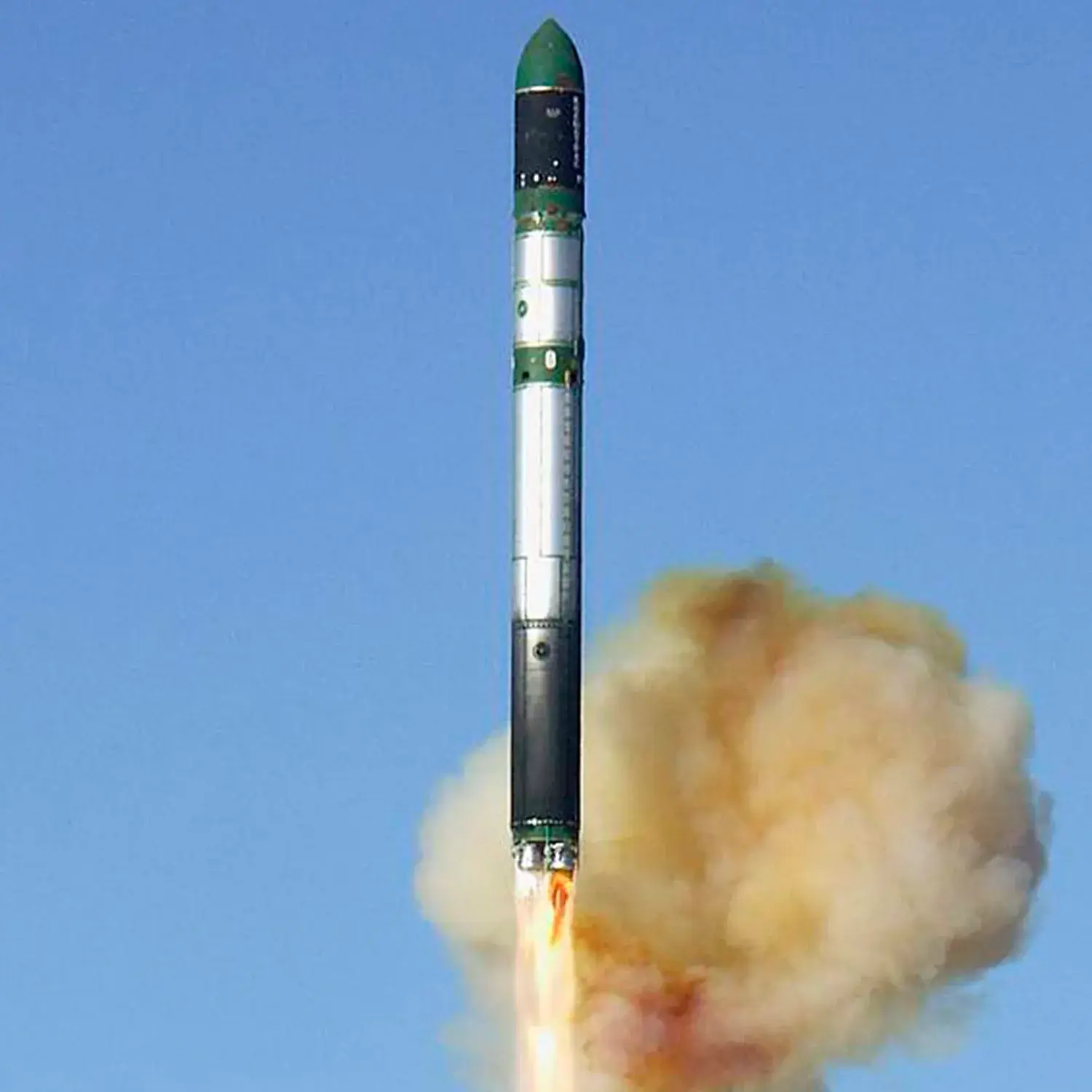
Dnepr
4th
Mission
1st
Mission of 2004
2004
25th
Orbital launch attempt