/
Tianhui-1 04
Launch Success
Liftoff Time (GMT)
04:01:00
Thursday July 29, 2021
Mission Details
Read Article
Tianhui-1 04
Tianhui 1 (TH-1) is a stereo-topographic mapping satellite developed by China SpaceSat Co. Ltd., a commercial branch of China Academy of Space Technology (CAST), with the development commencing in 2005. The satellite is similar in roles and capability to Ziyuan 3 but features a different electro-optical mission payload developed by the Changchun Institute of Optics, Fine Machinery, and Physics (CIOMP) of the China Academy of Sciences (CAS). Tianhui 1 is equipped with a three-line array panchromatic camera with a spatial resolution of 5 metres, a panchromatic CCD camera with a spatial resolution of 2 metres, and a multi-spectral imager with a spatial resolution of 10 metres. The swath width of the cameras is 60 km. The satellite operates on a 500 km polar orbit inclined at 97.3°, and could cover all areas on the Earth's surface between 80°N and 80°S latitude every 58 days. The satellite is based on the CAST2000 bus, with an orbital mass of around 1,000 kg. To achieve accurate quantitative surveys of the Earth, the satellite requires long-duration, high-precision three-axis stabilisation in orbit, which is achieved by integrating three-star sensors directly with the electro-optical mission package, coupled with GPS input. GPS coordinates data are also transmitted to ground station to be overlaid with the satellite imagery in further data processing.
Sun-Synchronous Orbit
1 Payload
1,000 kilograms
Rocket

Agency
CASCPrice
$29.75 million
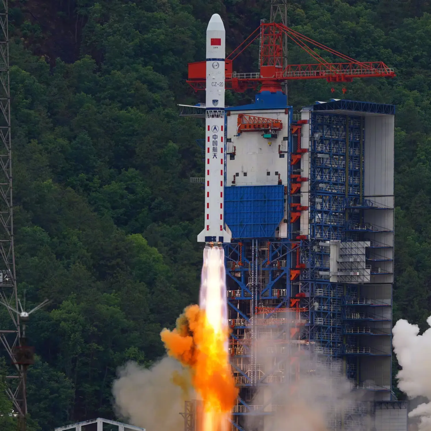
Rocket
Height: 40.77m
Payload to Orbit
LEO: 3,500 kg
GTO: 1,200 kg
Liftoff Thrust
2,962 Kilonewtons
Fairing
Diameter: 3.35m
Height: 7.82m
Stages
2
Launch Site
Stats
Long March 2D
54th
Mission
3rd
Mission of 2021
2021
69th
Orbital launch attempt